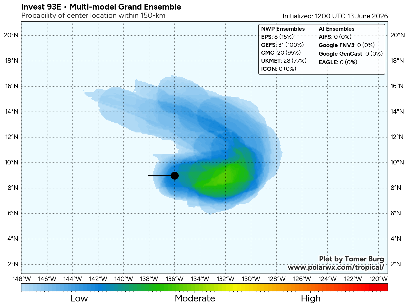
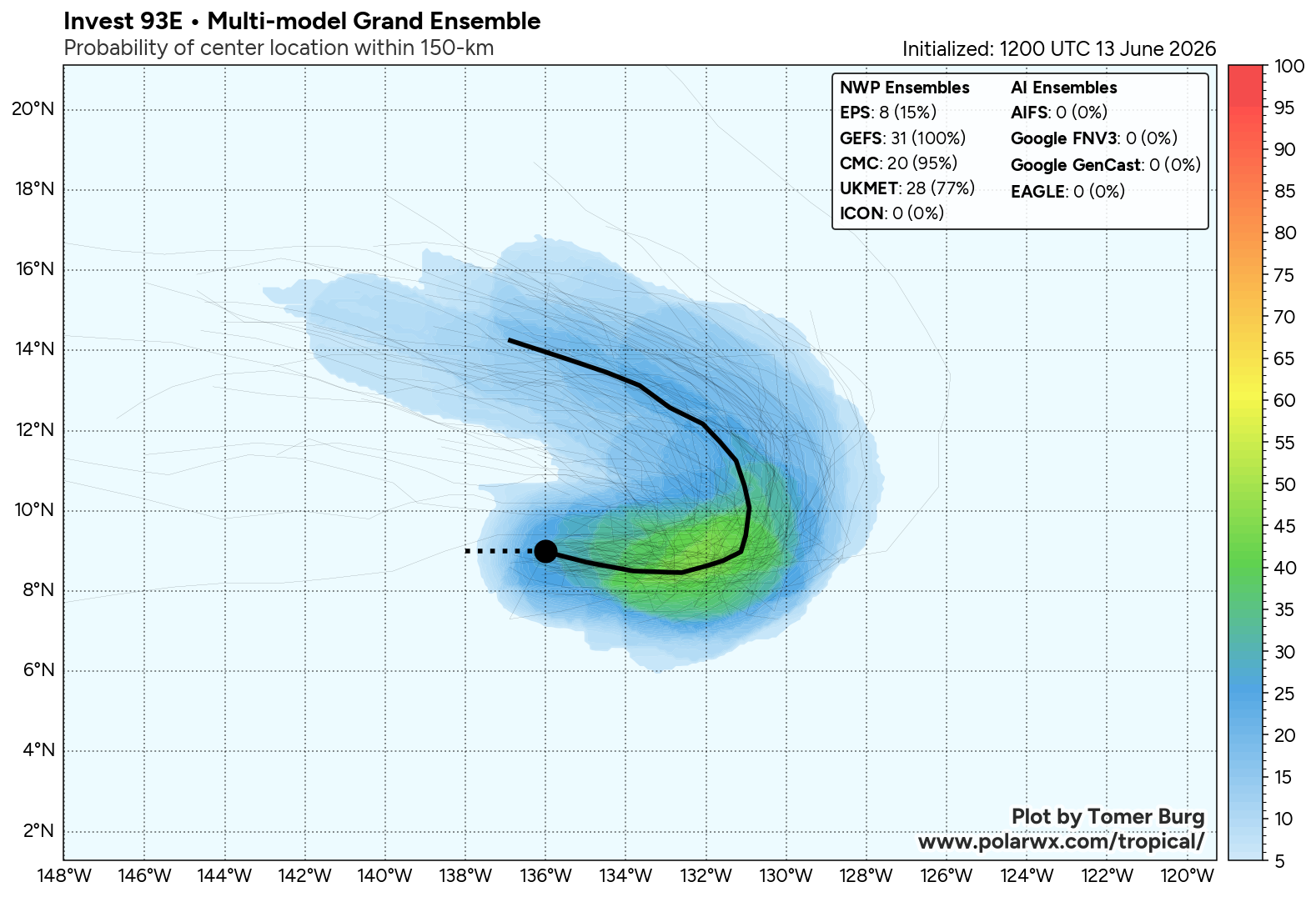
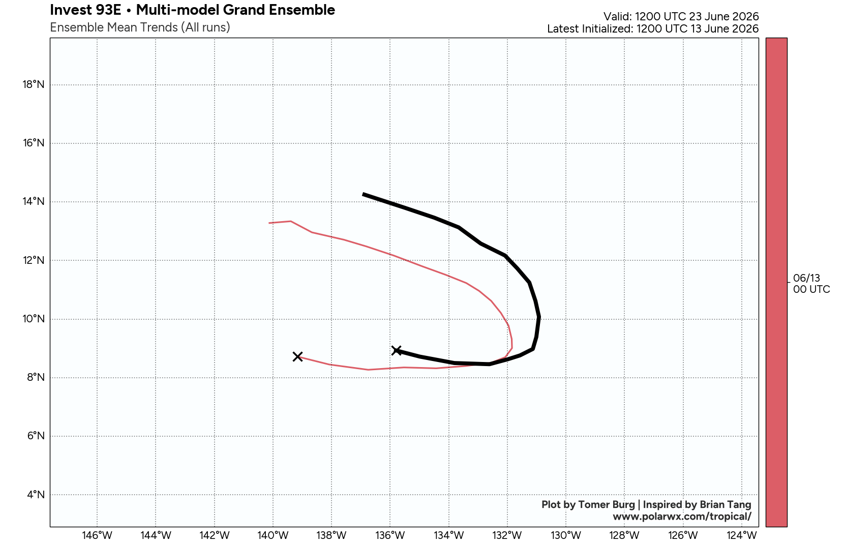
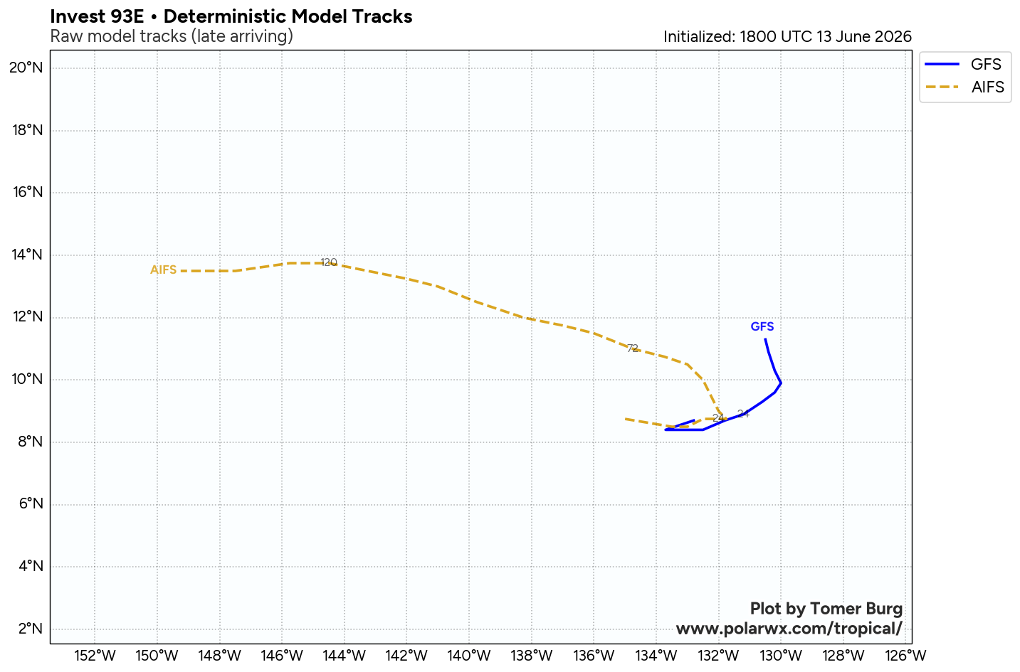
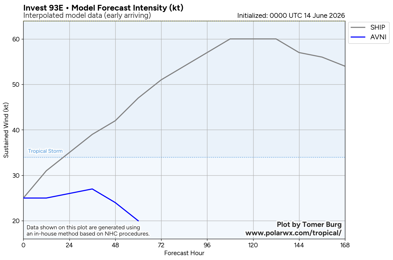
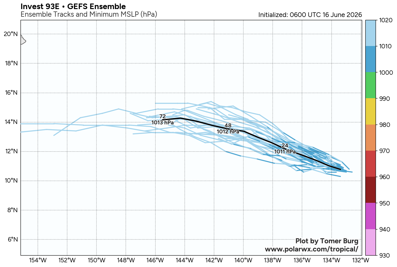
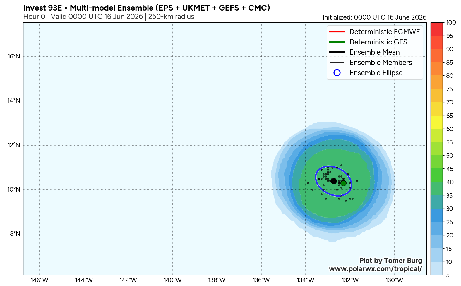
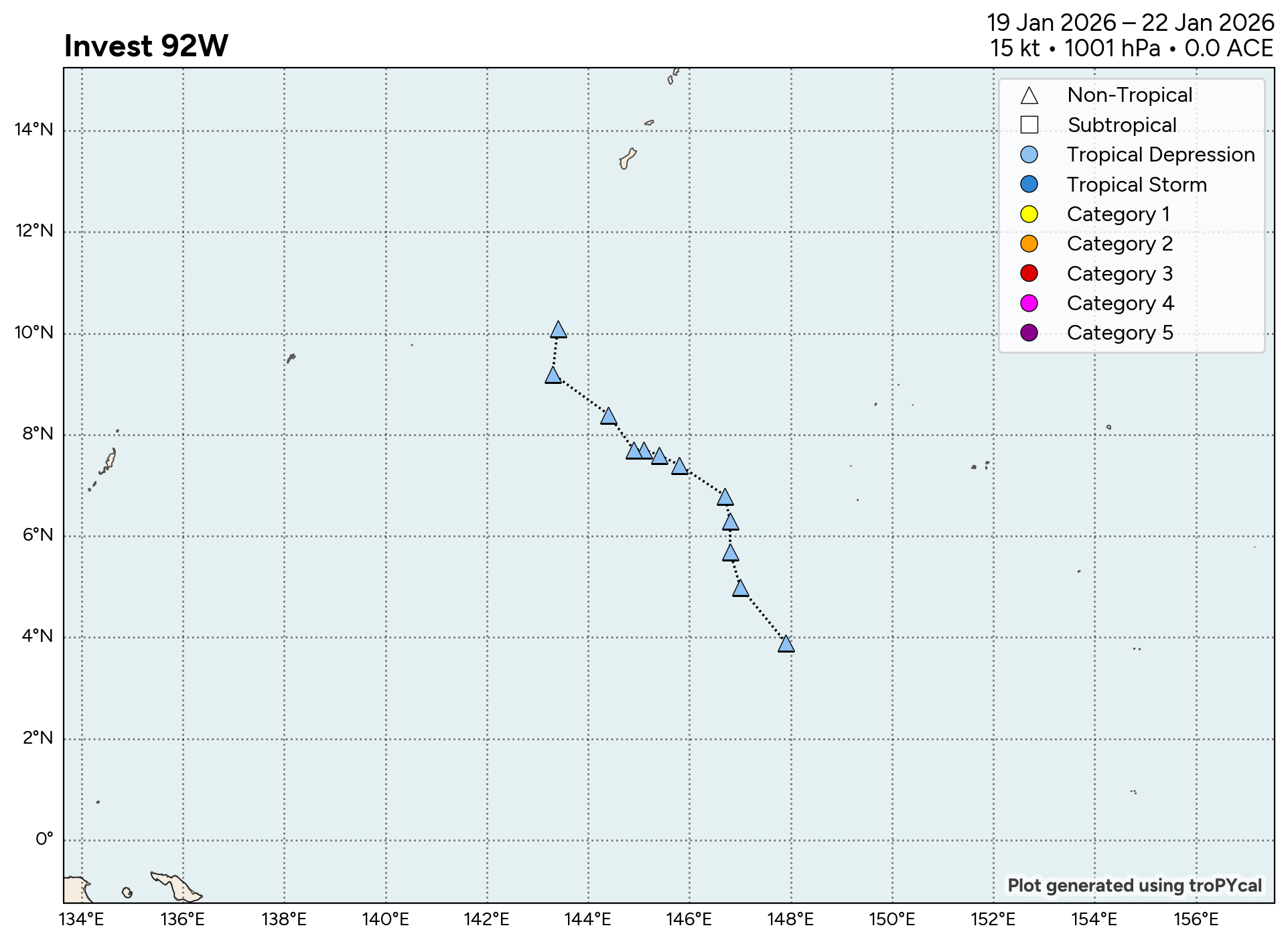
JTWC Issued: 1300 UTC 16 Jun 2026
The area of convection (invest 92W) previously located near 10.2N 161.9E is now located near 10.4N 154.4E, approximately 597 nm east-southeast of naval station Guam. Animated enhanced infrared satellite imagery (EIR) depicts 92W with persistent deep convection obscuring the low-level circulation center (LLCC). A partial 161002z ASCAT MetOp-C pass shows elevated winds in the eastern periphery but the pass missed the western and southwestern quadrants, where the weakest wrapping has occurred thus far. Therefore, there is low confidence in whether or not a closed circulation exists or if 92W remains a wave. Environmental analysis reveals a favorable environment for development with low vertical wind shear (5-10 kts), warm sea surface temperatures (30 C), and moderate poleward outflow aloft. Global deterministic models show limited significant development in the near-term, but ensemble models agree on slow development within the next 48-72 hours with a west-northwestward track.
Maximum sustained surface winds are estimated at 18 to 23 knots. Minimum sea level pressure is estimated to be near 1010 mb. The potential for the development of a significant tropical cyclone within the next 24 hours is upgraded to medium.