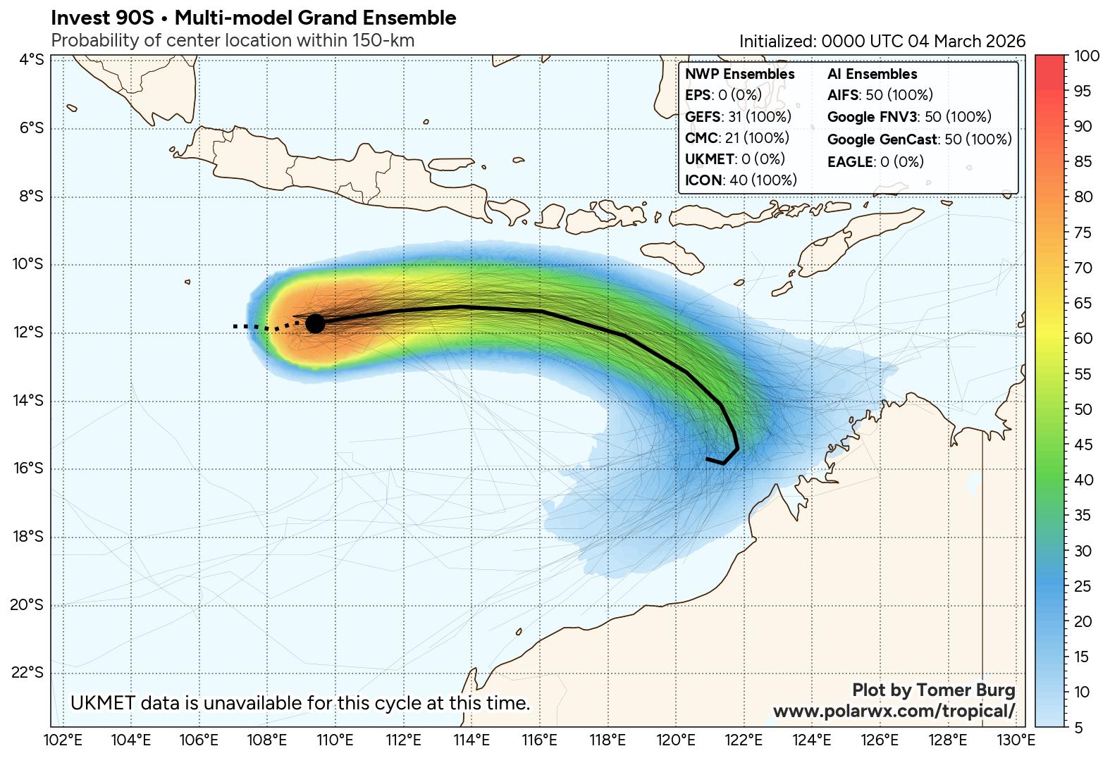
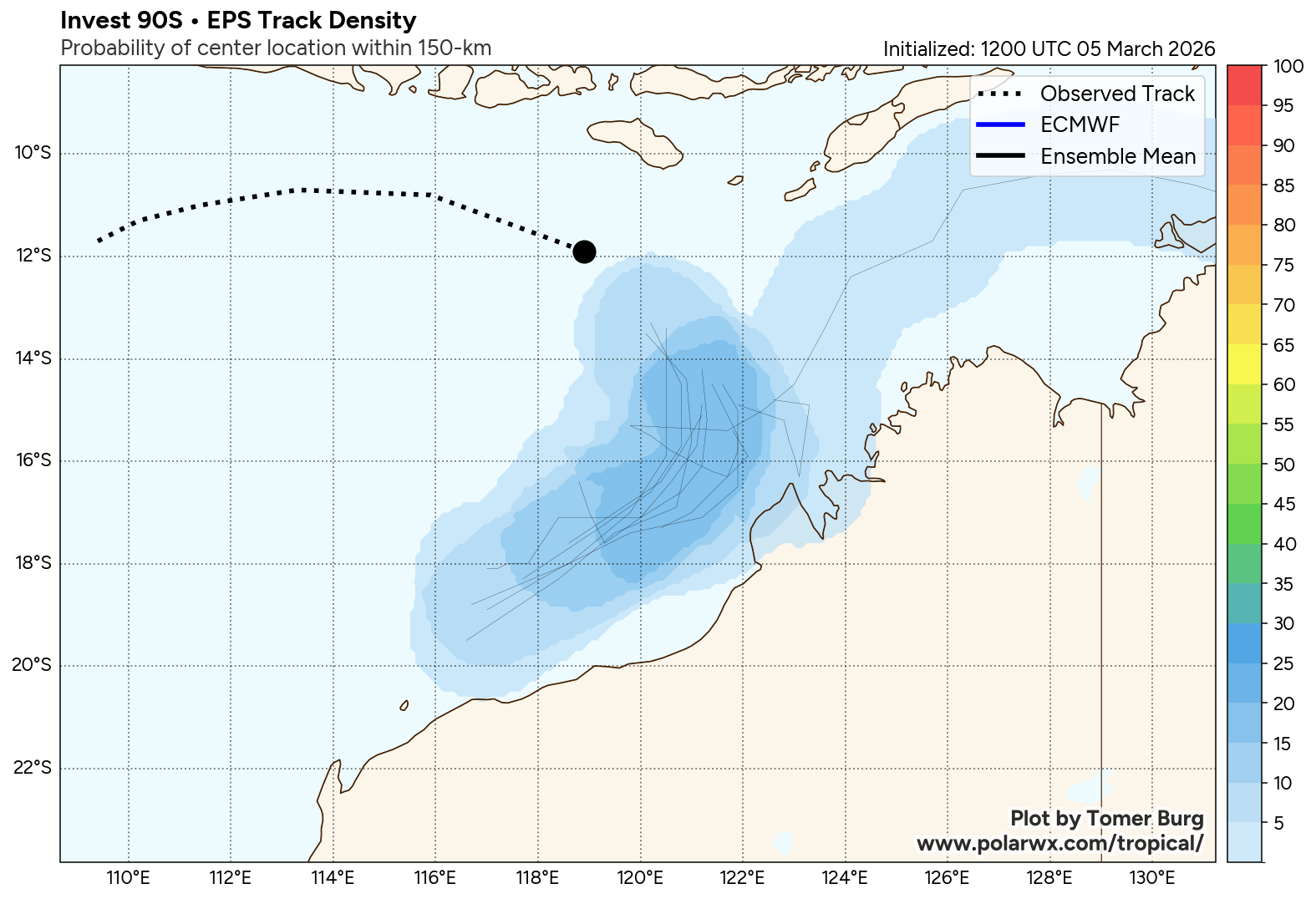
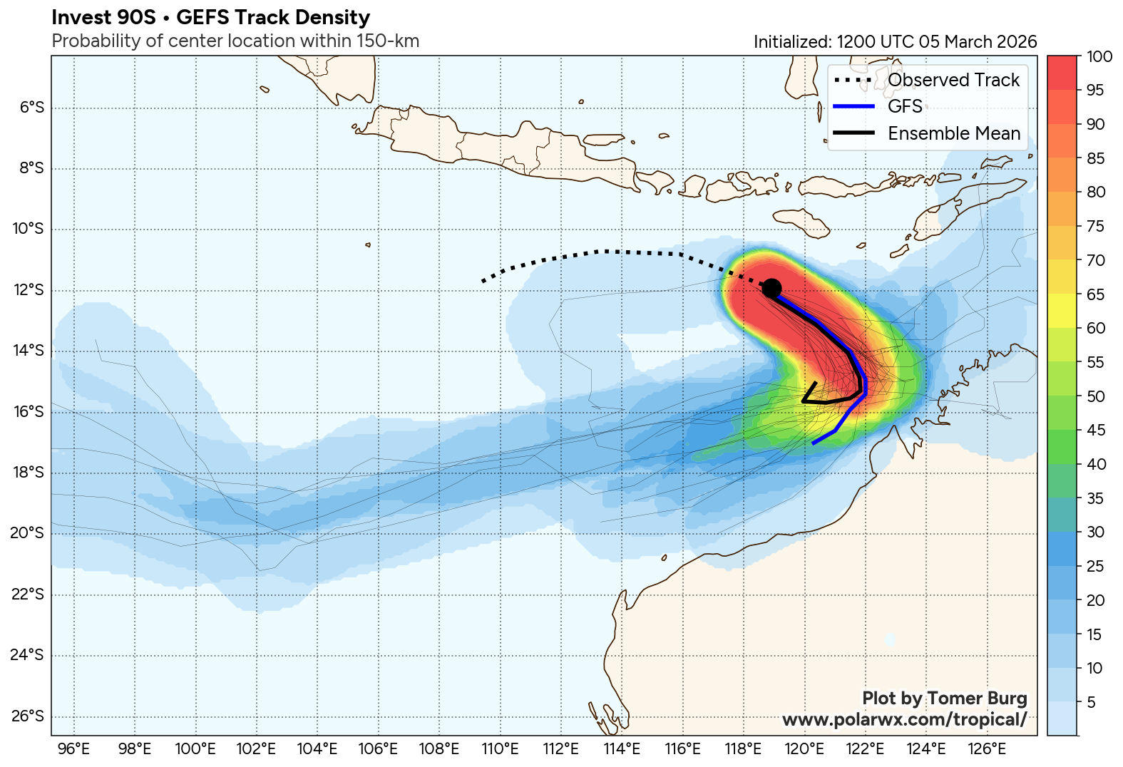
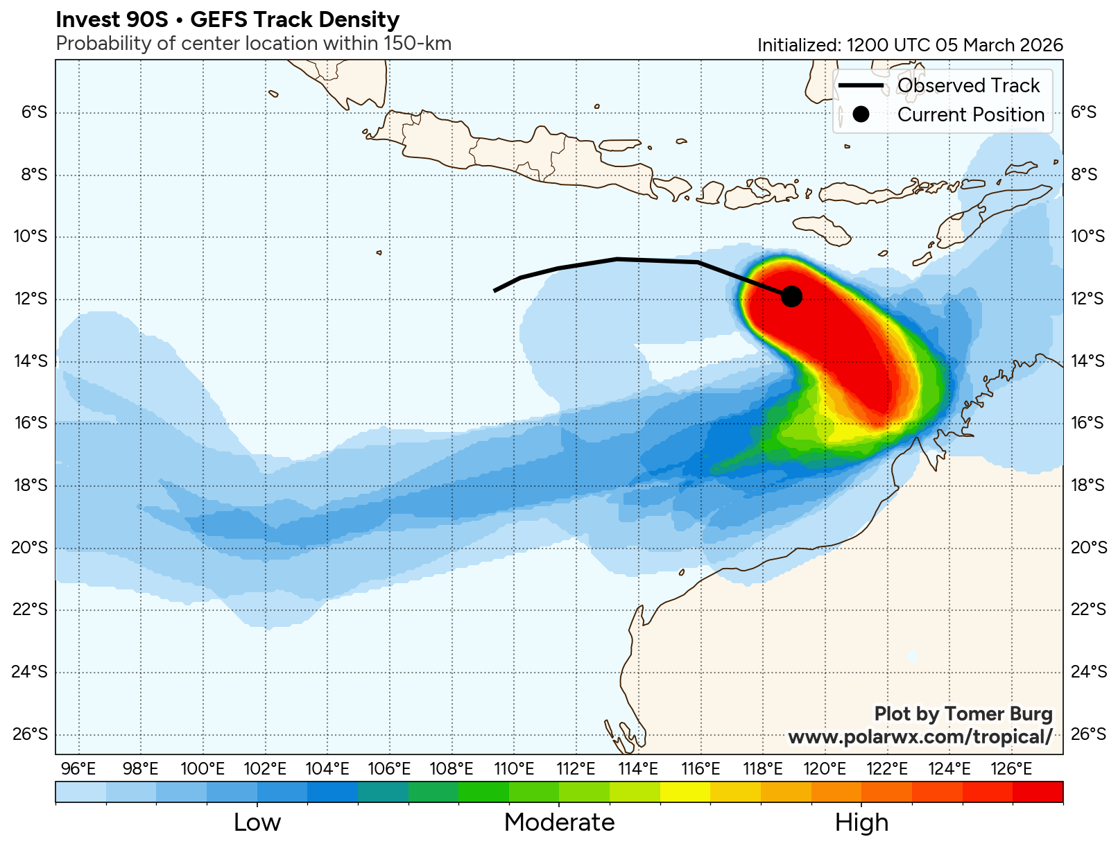
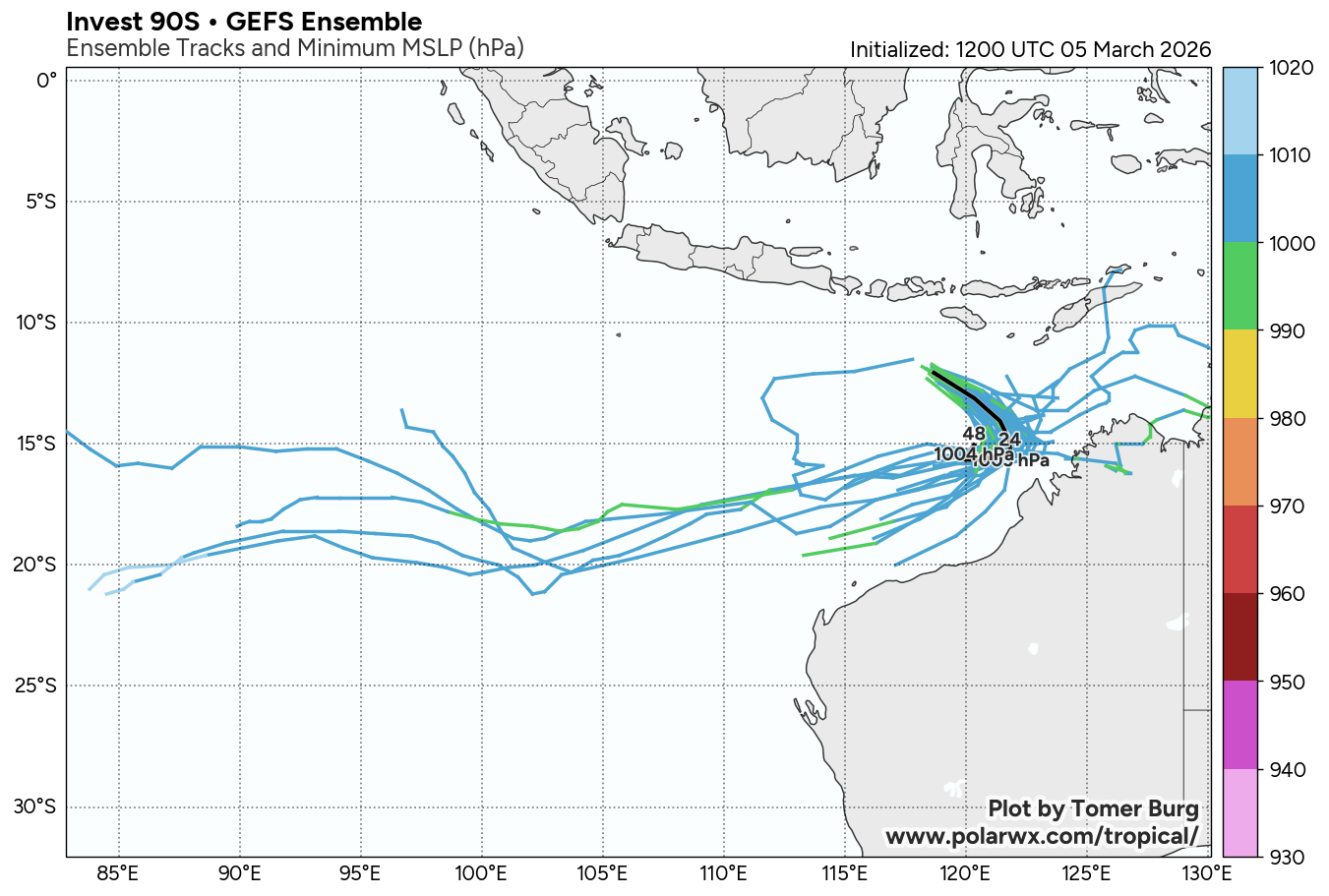
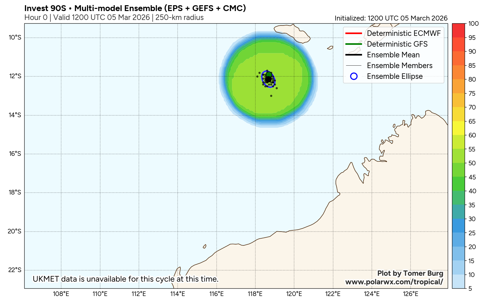
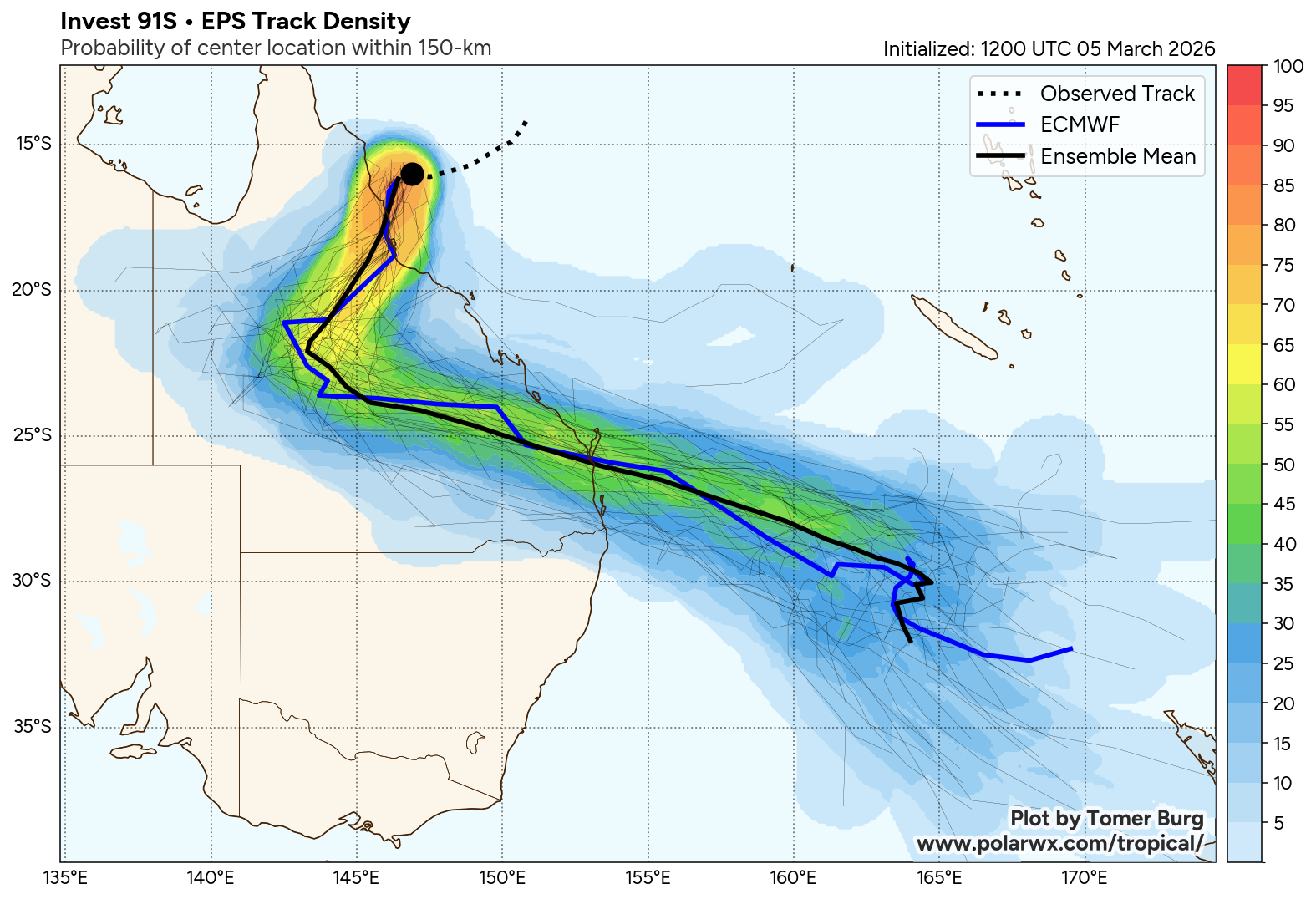
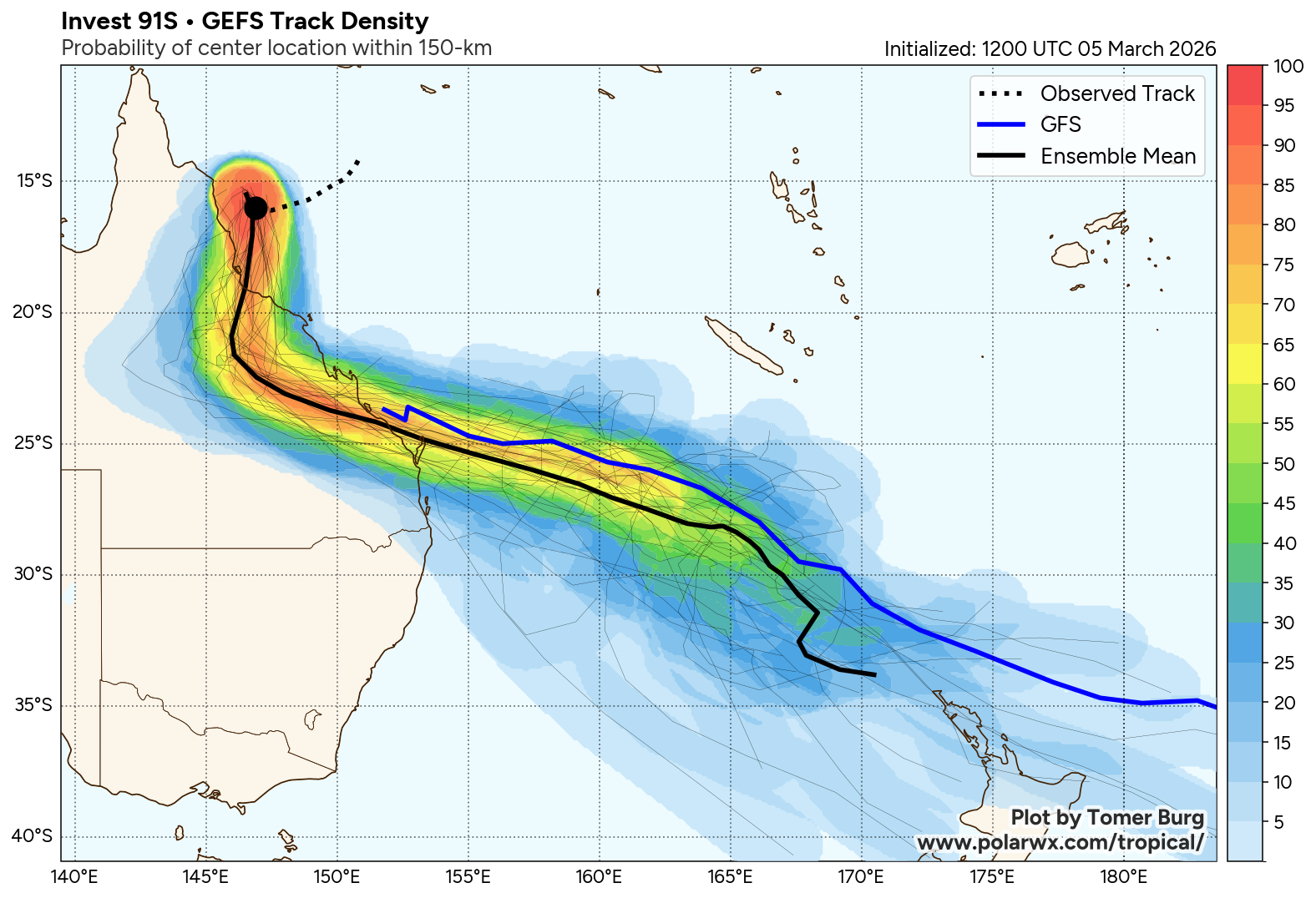
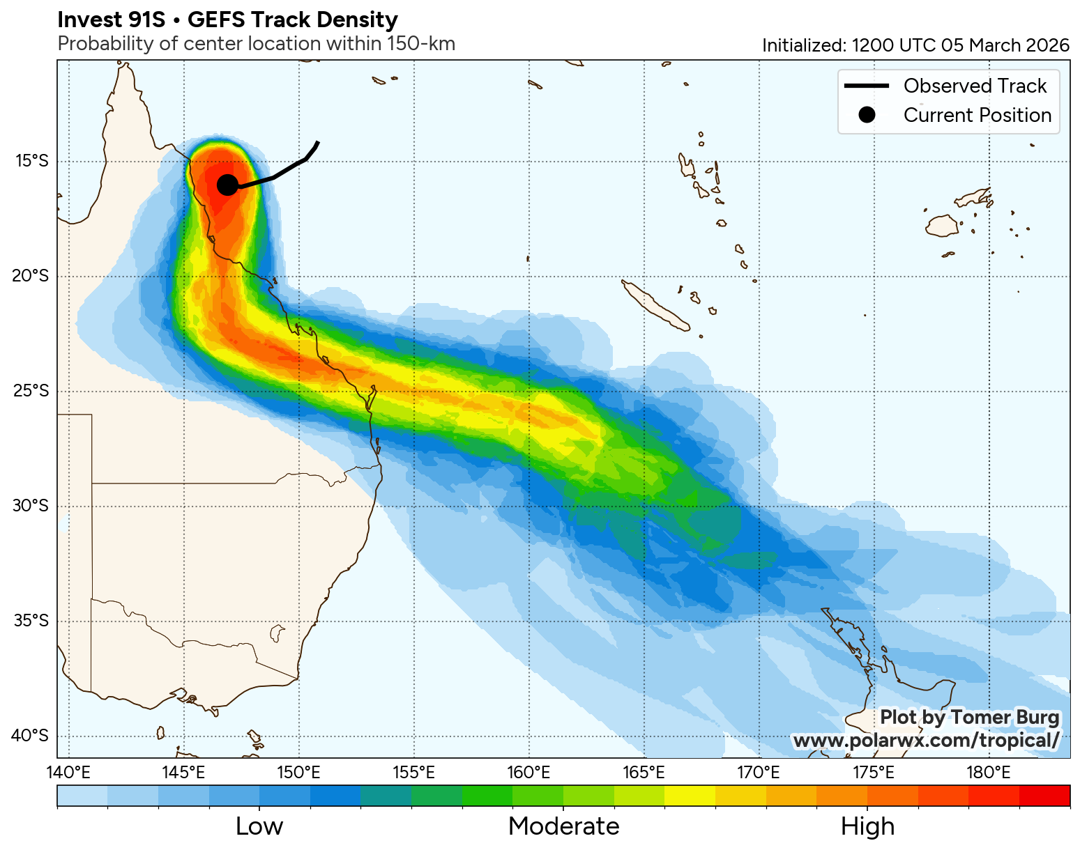
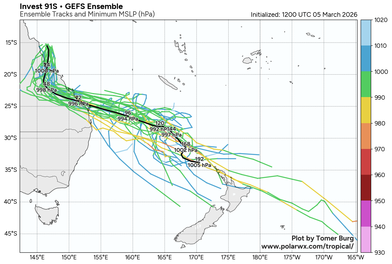
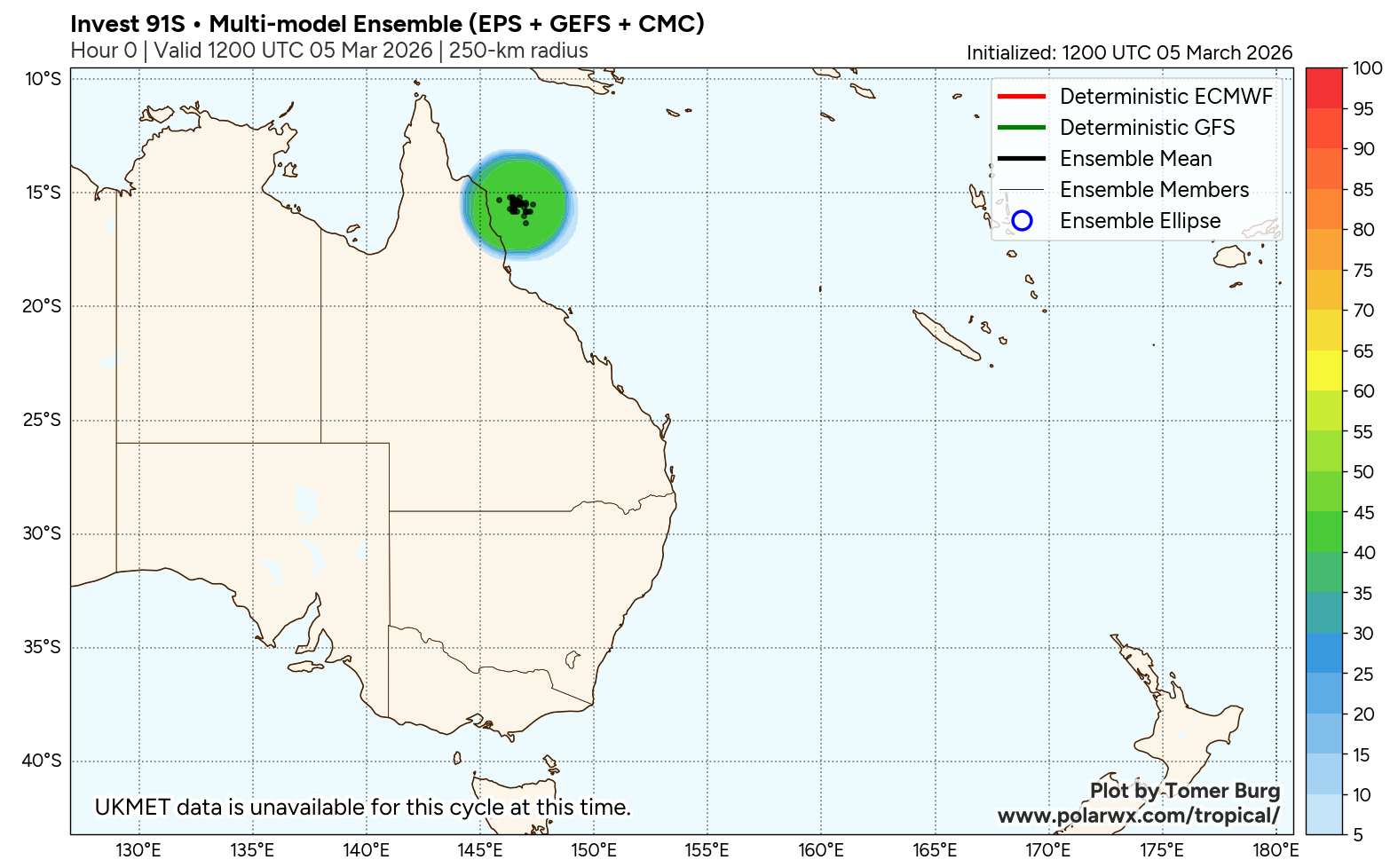
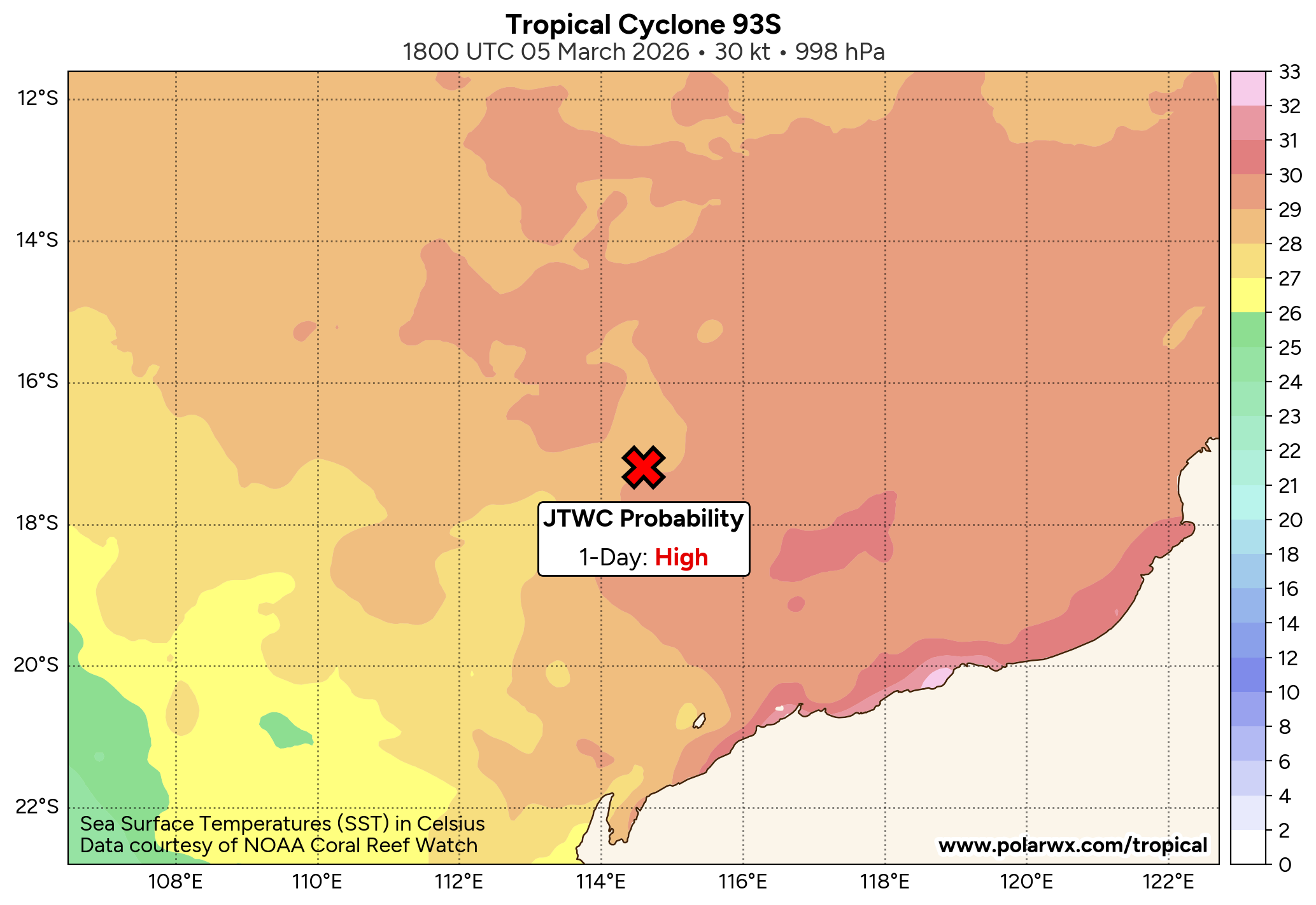
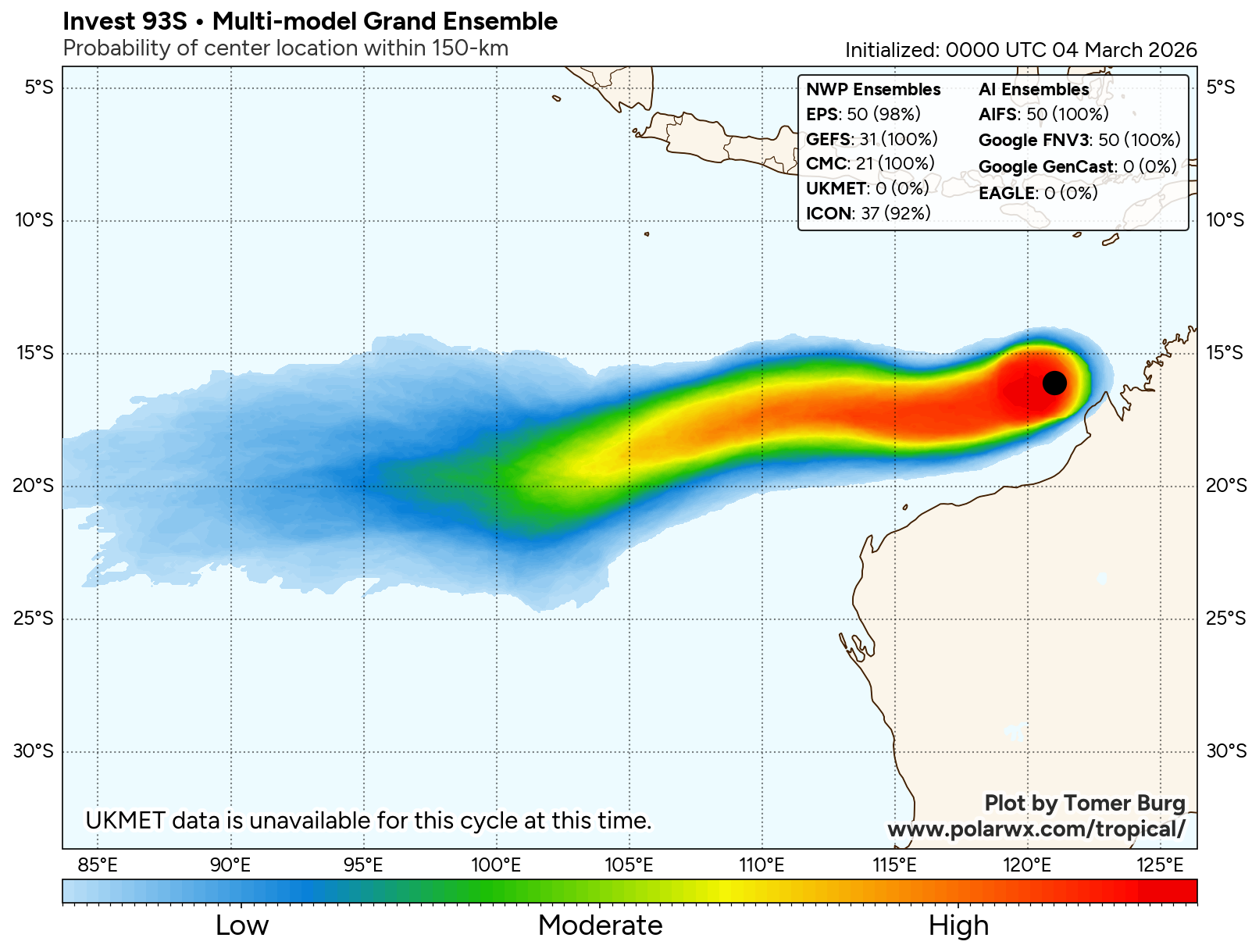
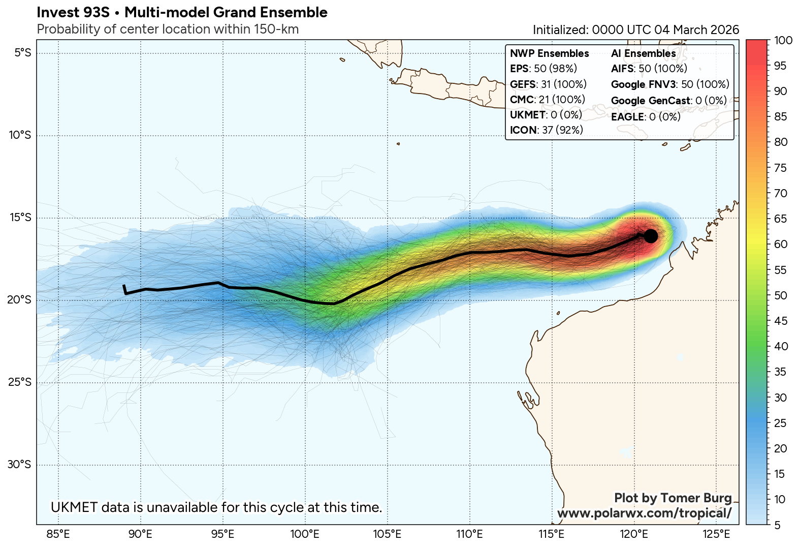
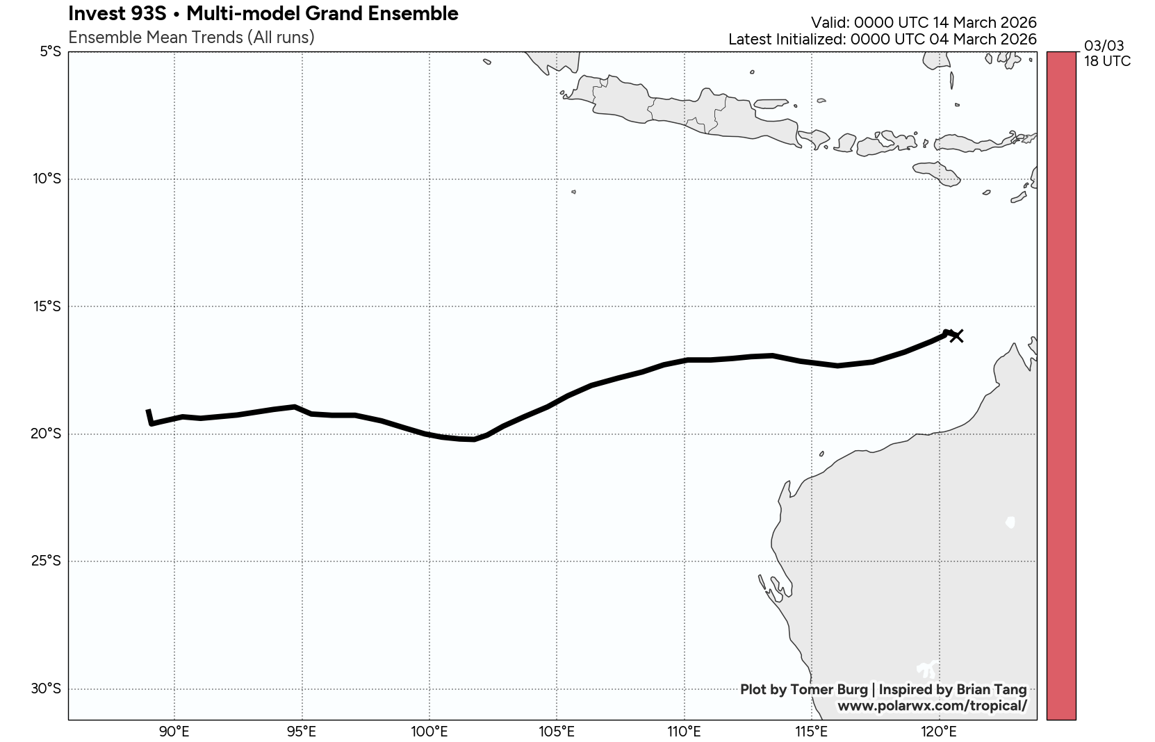
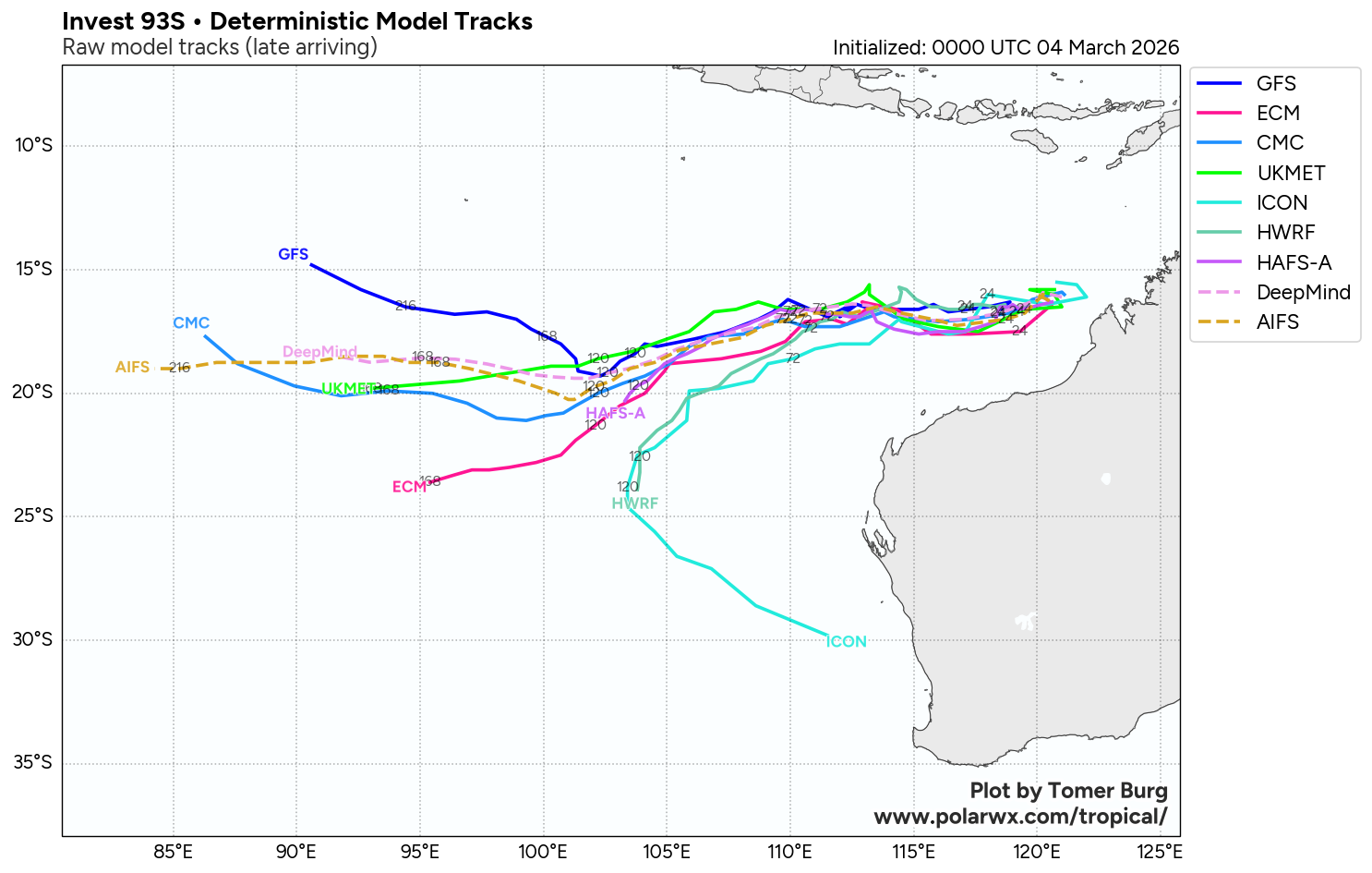
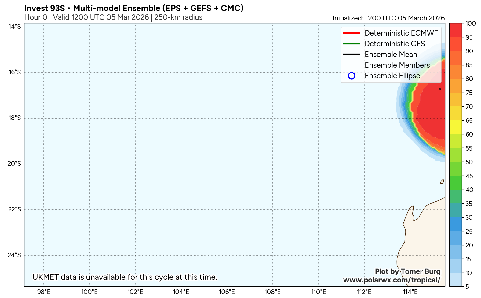
JTWC Issued: 1800 UTC 5 Mar 2026
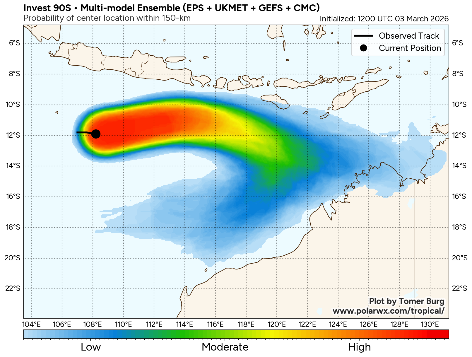
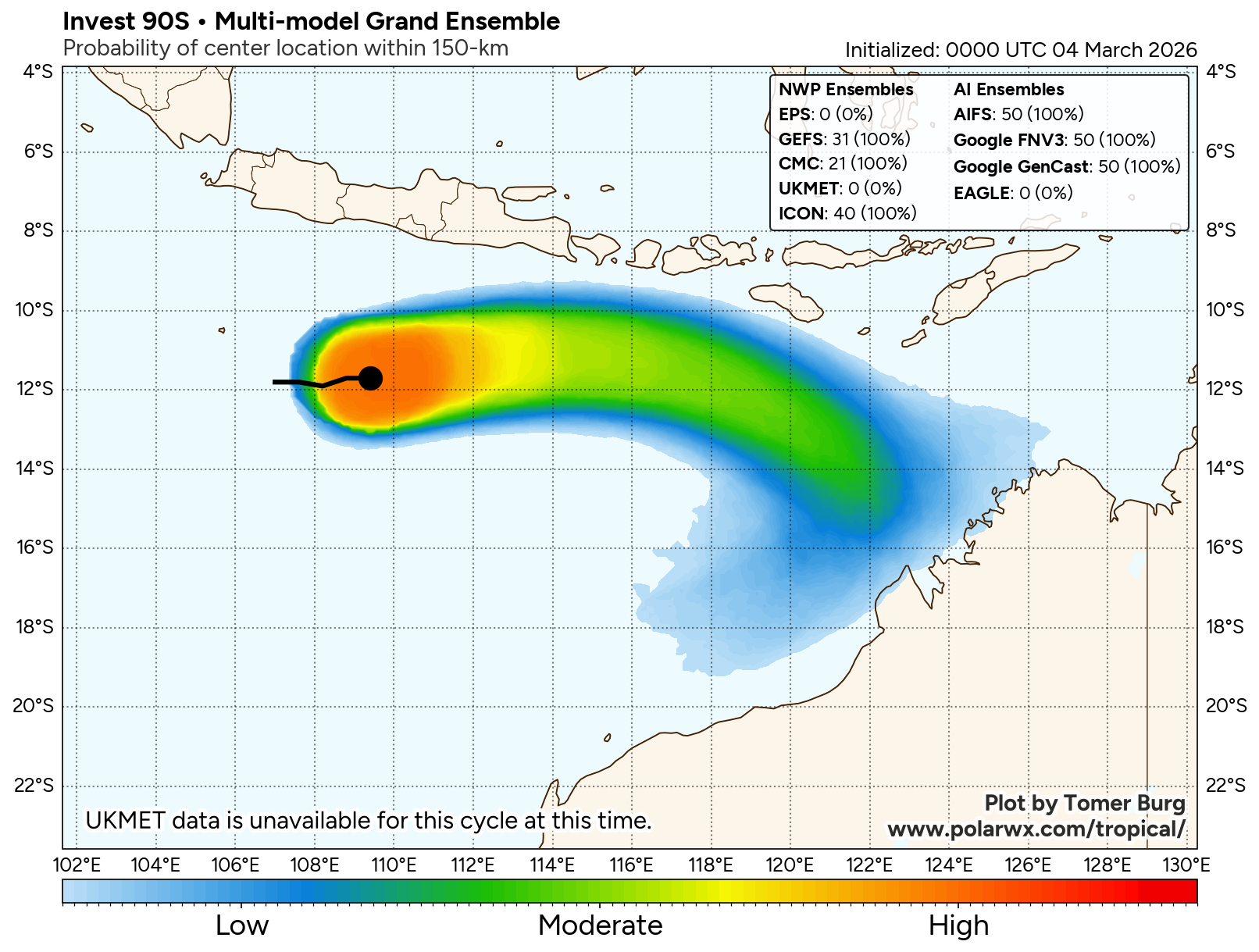
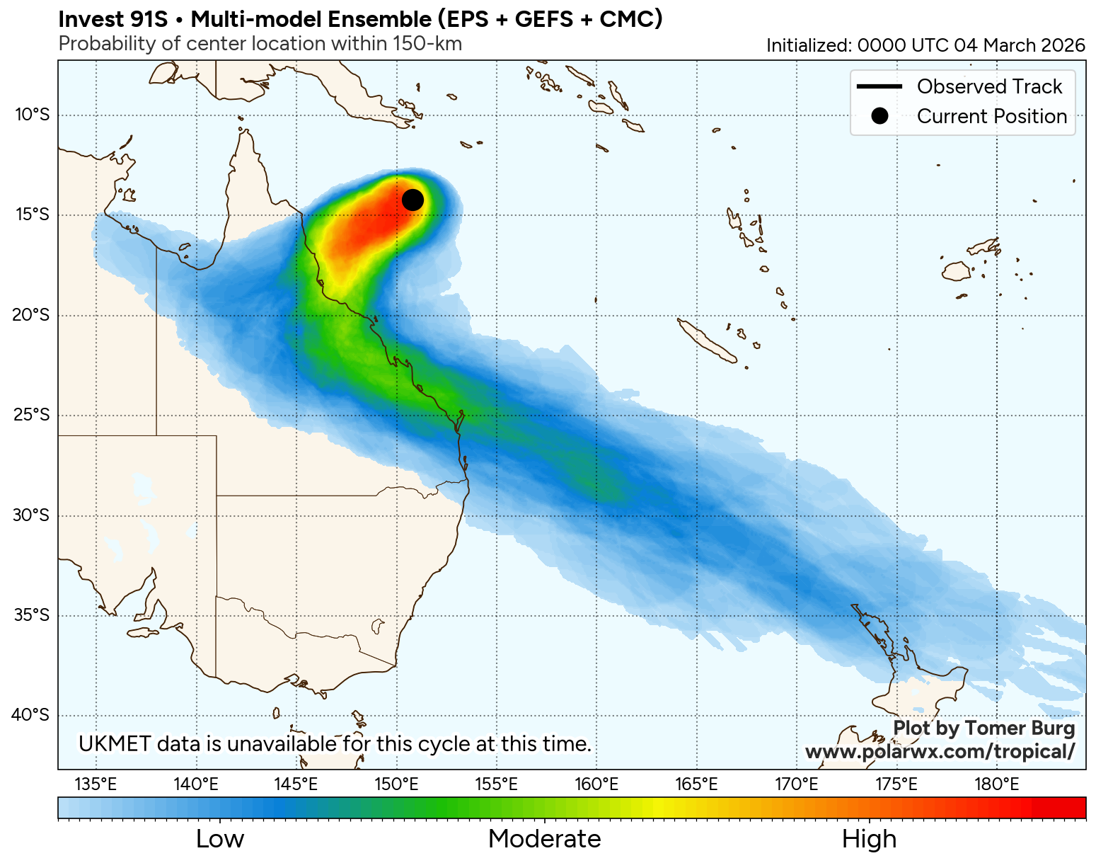
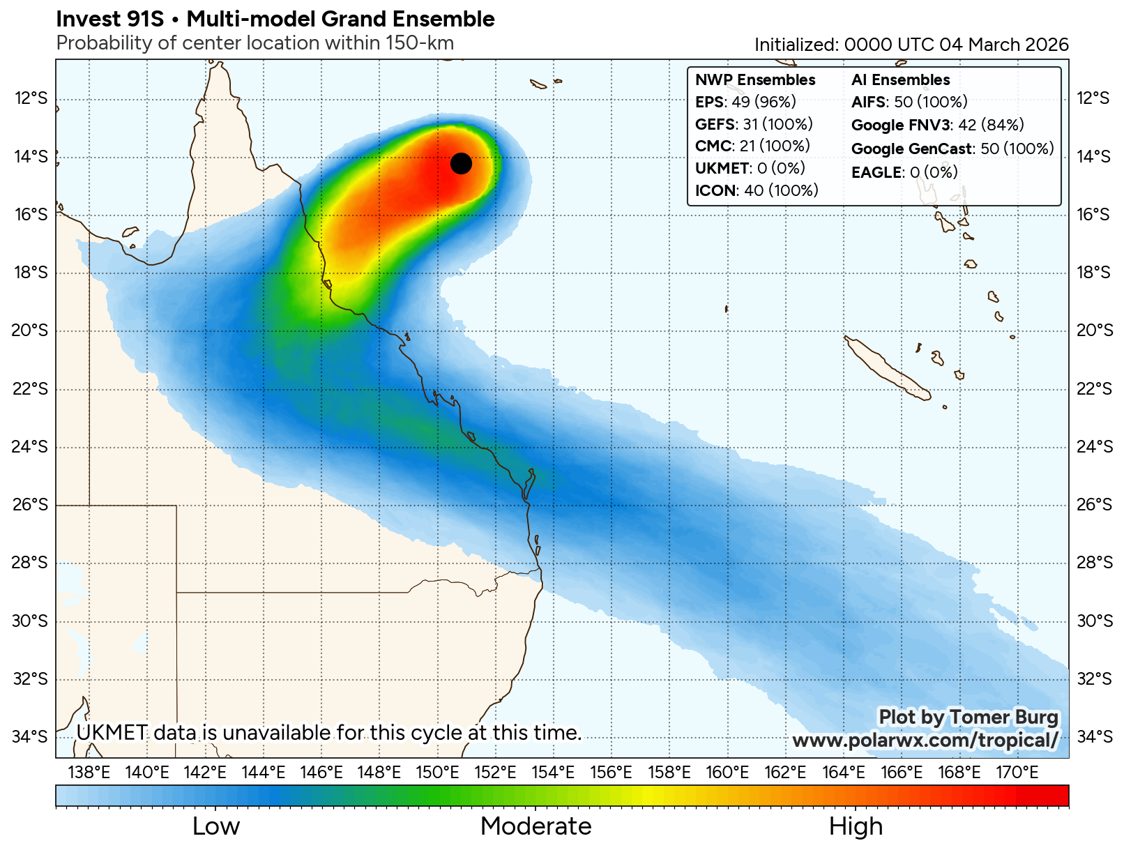
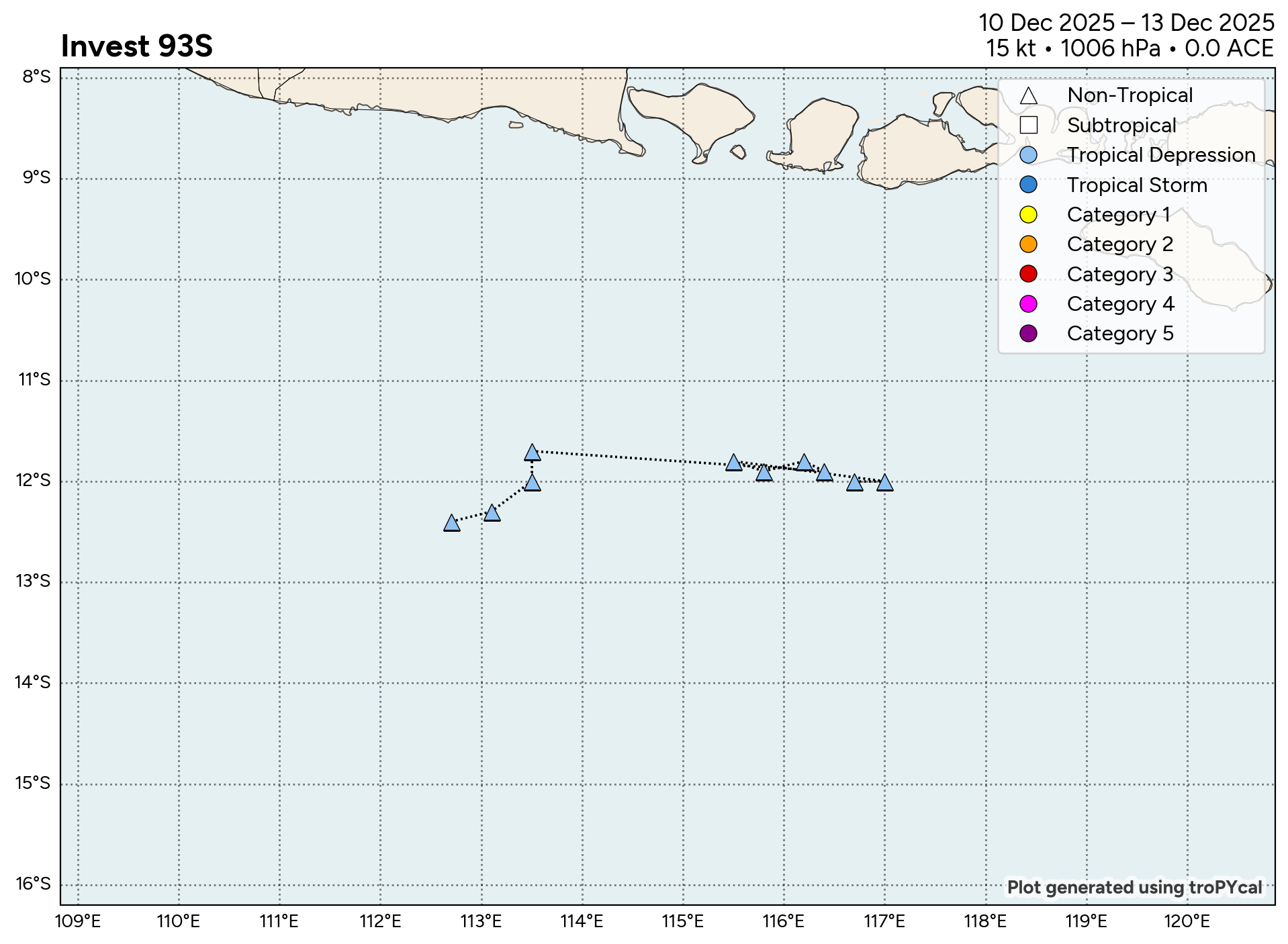
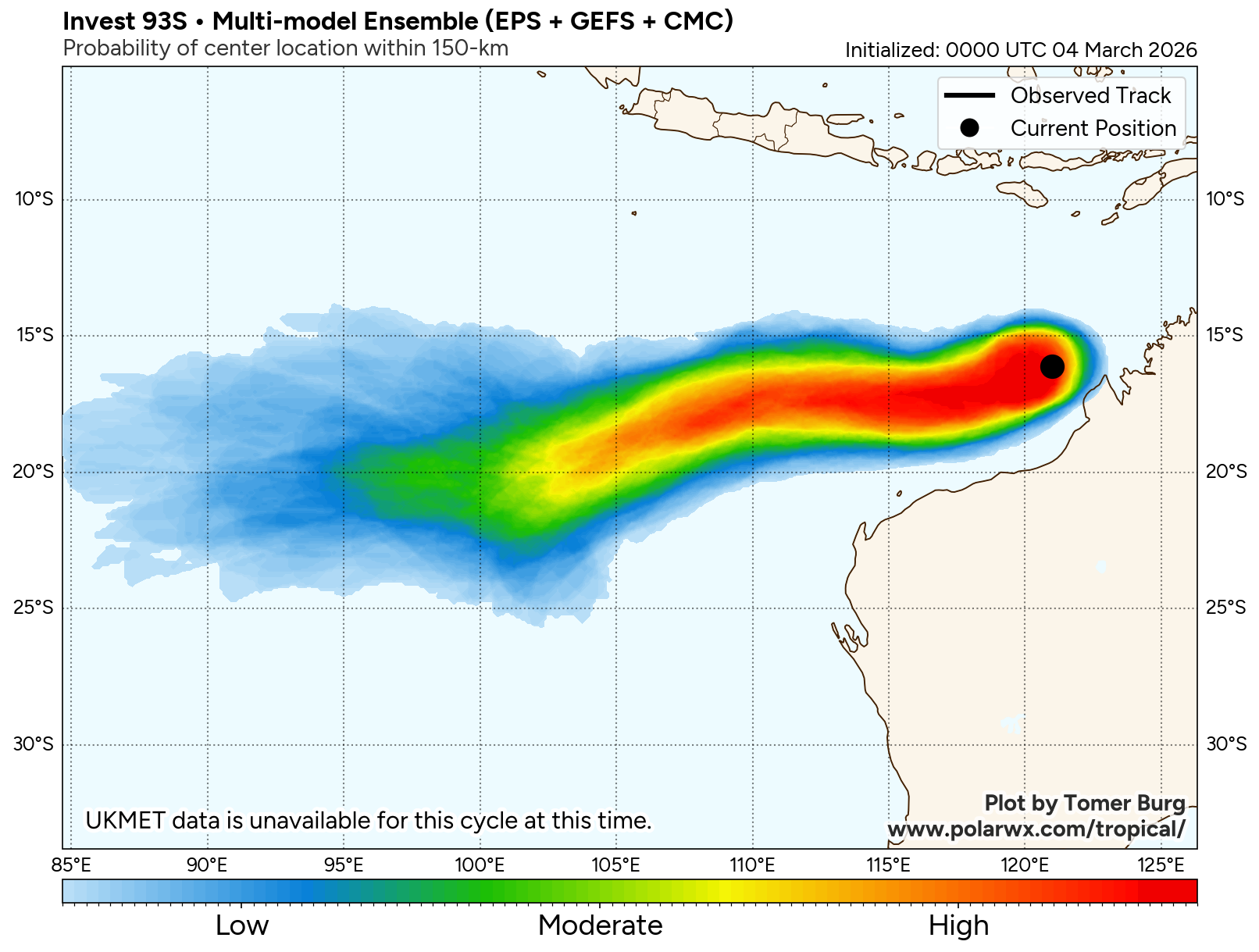
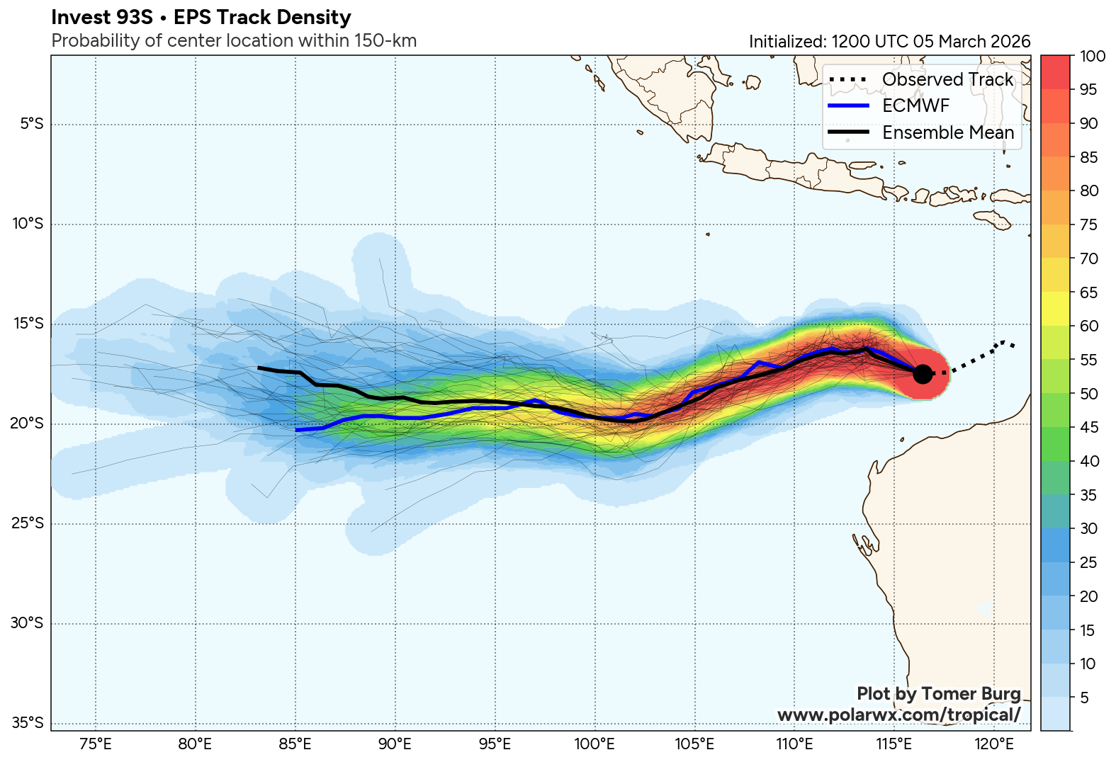
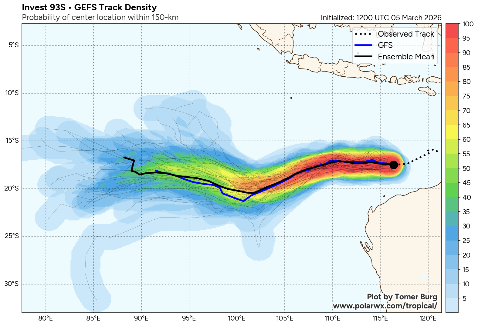
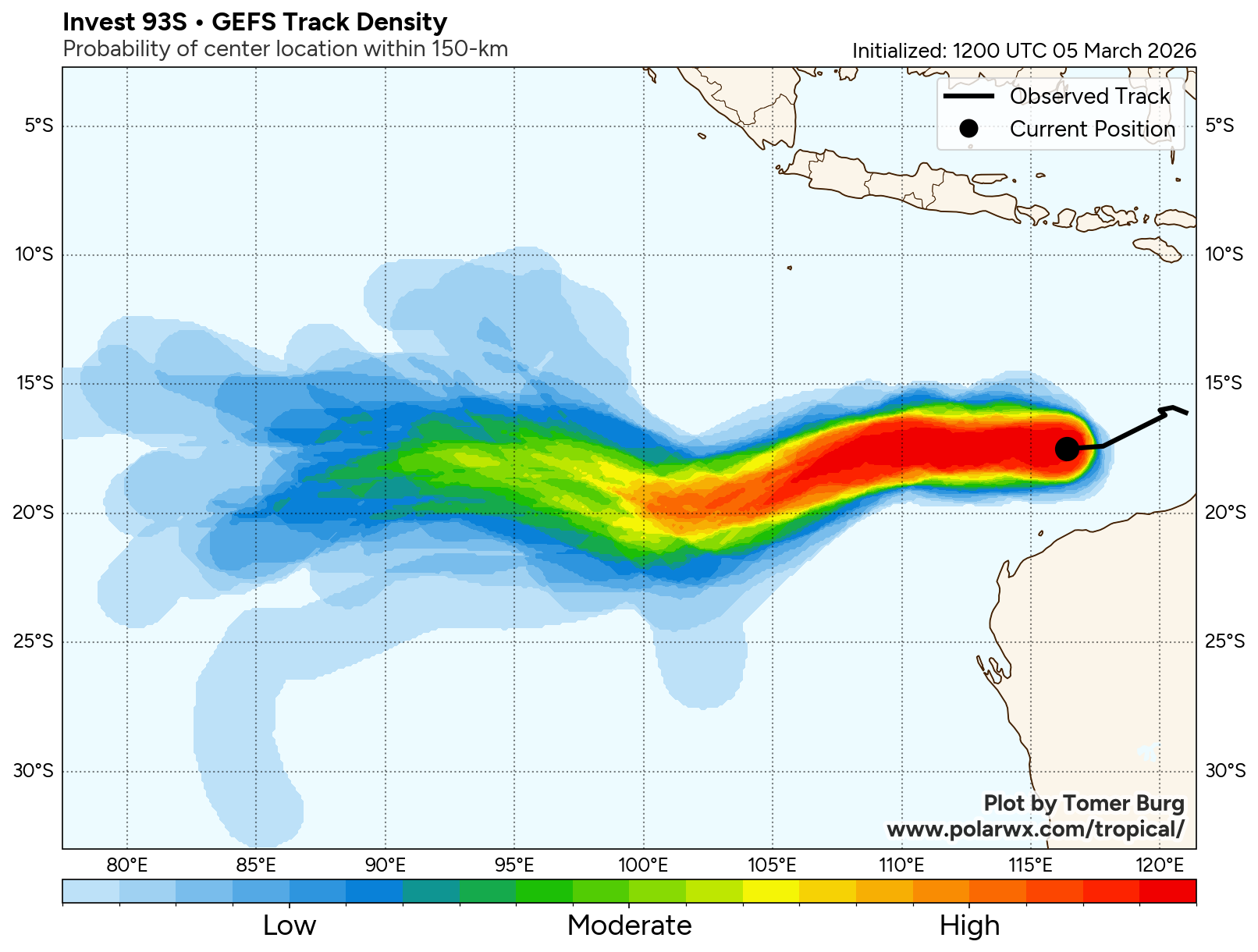
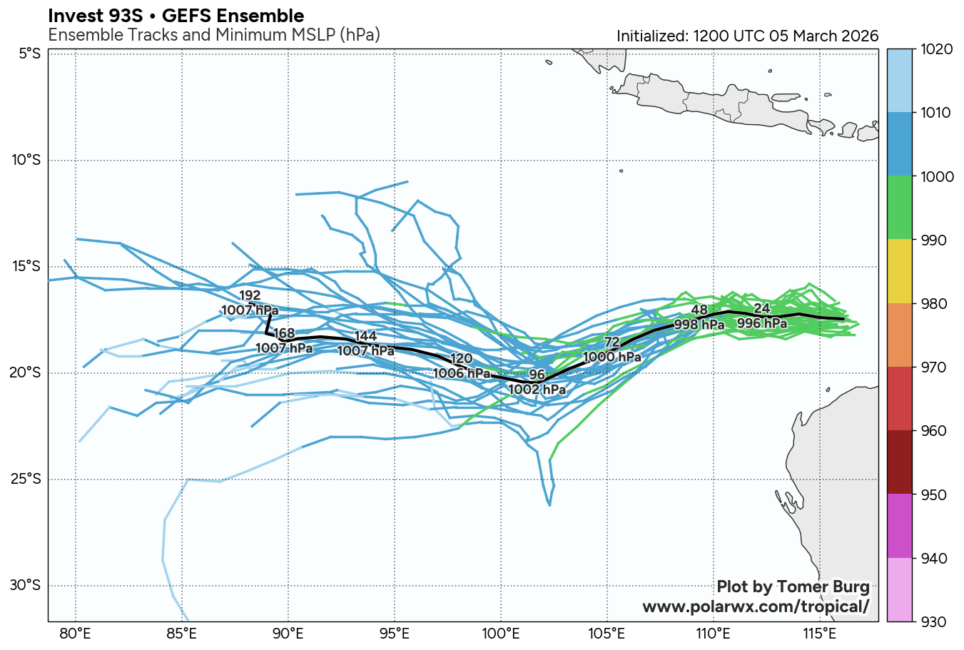
The area of convection (invest 93S) previously located near 16.1S 121.0E is now located near 17.5S 116.4E, approximately 314 nm north of learmonth. Animated multispectral satellite imagery depicts a partially exposed low-level circulation center with deep flaring convection largely displaced to the west of the circulation. Environmental analysis depicts a marginally favorable environment for development with good equatorward upper-level outflow, low to moderate vertical wind shear (15-20 kts), and warm sea surface temperatures (29-30 c). Global deterministic models delay the consolidation of 93S while ensemble models show further development in the next 24 hours. Overall models are in agreement with a westward track over the next 48-72 hours.
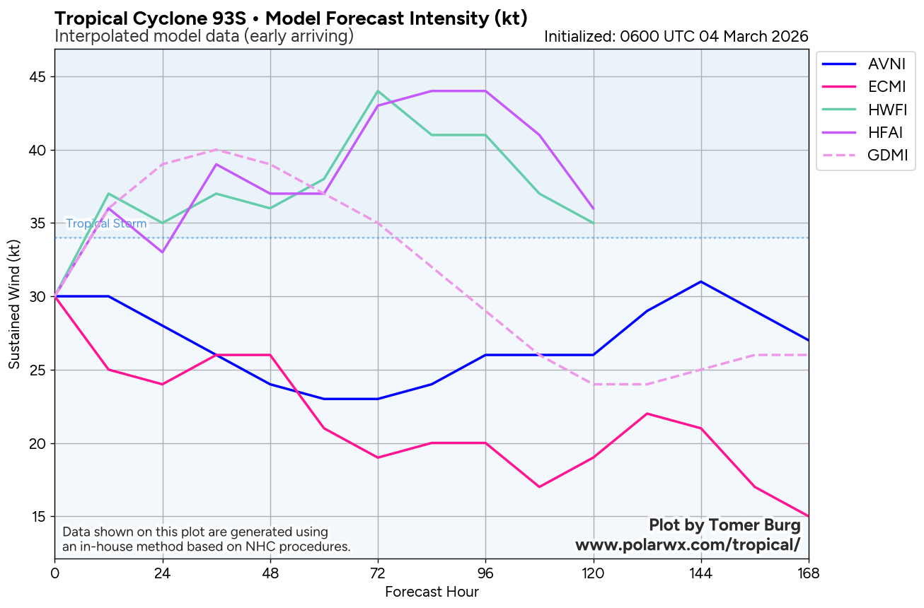
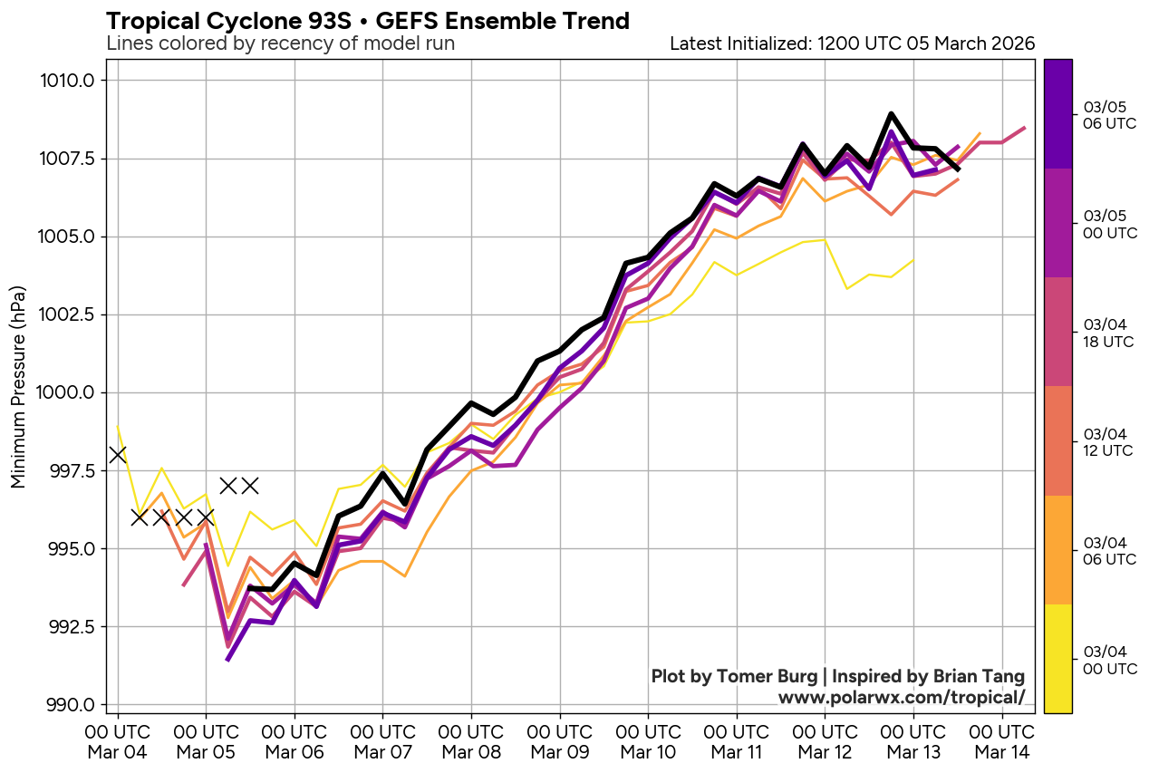
Maximum sustained surface winds are estimated at 28 to 33 knots. Minimum sea level pressure is estimated to be near 997 mb. The potential for the development of a significant tropical cyclone within the next 24 hours remains high. See ref b (wtxs21 pgtw 051430) for further details.